The Lavase River flows into Lake Nipissing and was part of the canoe route to Western Canada.
It’s fun to think that for 150 years, Northwest Company Voyageurs on their way West in large canoes, passed this very spot.
The Lavase River flows into Lake Nipissing and was part of the canoe route to Western Canada.
It’s fun to think that for 150 years, Northwest Company Voyageurs on their way West in large canoes, passed this very spot.
Filed under Photographs
All summer, Lake Nipissing has been about 2 feet lower than it normally is. In past years, wet feet would have been necessary to produce this photograph.
The spring melt happened so early this year that water that would have been trapped in the ground ran off to the Great Lakes because the ground was still frozen. Nipissing was not able to catch up over the summer and despite recent, rains is still behind.
Climate Change?
Filed under Photographs
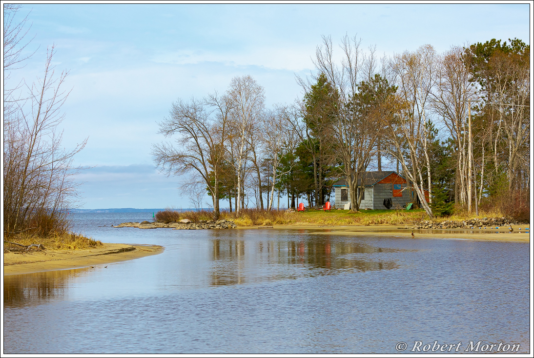
This is the mouth of the Lavase River, where it enters Lake Nipissing. For 150 years The Voyageurs paddled through this channel in the spring, on their way west to Thunder Bay on Lake Superior. The return voyage passed this point and ended up in Montreal in the Autumn. Lake Nipissing is controlled by dams on the French River these days, and there are navigation markers in place. However the place is pretty much the same as it would have been 150 years ago.
In the spring the water would be much higher than it is in this photograph, but by fall it would probably have been as you see it here.
Filed under Photographs